
Copyright © Brent C.
Dickerson
I would again like to warmly thank California State University, Long
Beach, for generously hosting this site dedicated to fostering an
understanding of the people, conditions, and ethos of an earlier period
of our area. These materials, to be developed, elaborated, edited, and
updated continuously, are provided to enrich peoples' understanding of a
period of pre-Yankee California, and to deepen the understanding and
broaden the background for readers of my book The Bandini Papers,
as well as to supply corrections or "fine-tuning" arising from further
research. All materials on this site respect copyright law and the
doctrine of fair use. Should anyone know anything to the contrary
concerning a specific item, please have the person in possession of the
rights on the particular item or items contact me at once so I
can remove the material in question. The drawings, and details of
drawings, by William Rich Hutton which appear on this site are here by
very special and specific courtesy of the Huntington Library, San
Marino, California; requests concerning any further use of these
images by Hutton must be made not to me but rather to the Huntington
Library. While other images on this site have in many cases had
enhancements or changes of one sort or another for æsthetic or
historical reasons (in other words, to "fix" blemishes, or to clarify
the view to better elucidate Bandini's materials), these images of
Hutton's are presented as originally drawn, in the current state of the
originals, with at most a few pixels cropped around the perimeters to
provide a smooth-looking edge to the images. Those wishing to
contribute corrections or other matter relating to the text in the book
are not only welcome to contact me—they are encouraged to do
so via email at odinthor@csulb.edu. Please
include the source of the data supplied, and, if applicable, if it is
under copyright. Surprisingly, many books etc. which were duly
copyrighted at their initial publication did not have their copyright
renewed when the time came (a necessity under the laws then current),
and so fell into public domain. Contributors should indicate in their
messages whether they wish their names to be included should the
material be published on this site. Materials provided will be regarded
as being supplied voluntarily and gratis, with no anticipation of
monetary compensation. Current representatives of the families which
are mentioned in the text, or those which were present during the period
of the narrative, are also encouraged to contact me with pertinent
information, including family stories, about their ancestors and their
ancestors' doings. As in the book itself, notes are referenced by the
number of the paragraph in the text in which the item in question
occurs.
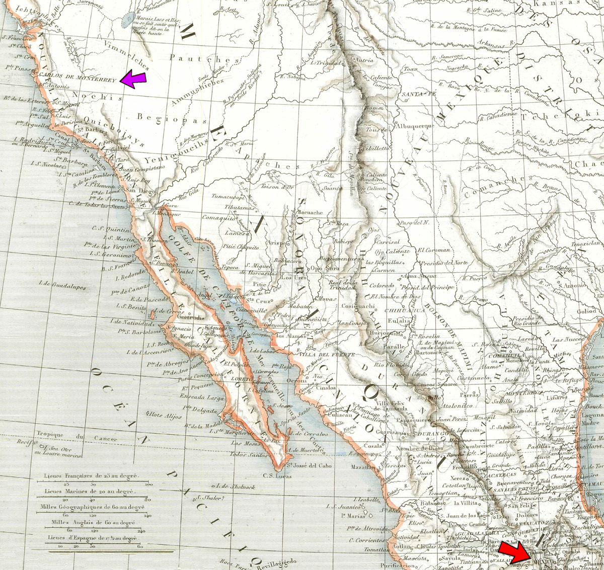
• Detail of an 1835 French-Mexican map, showing the land between Mexico City and San Francisco Bay. The red arrow indicates Mexico City; the violet arrow indicates Monterey, California (misspelled as "Monterrey" on the map) The arrow points to the word "Monterrey" as printed on the map, and so is well inland; but of course the actual town was and is along the shoreline.
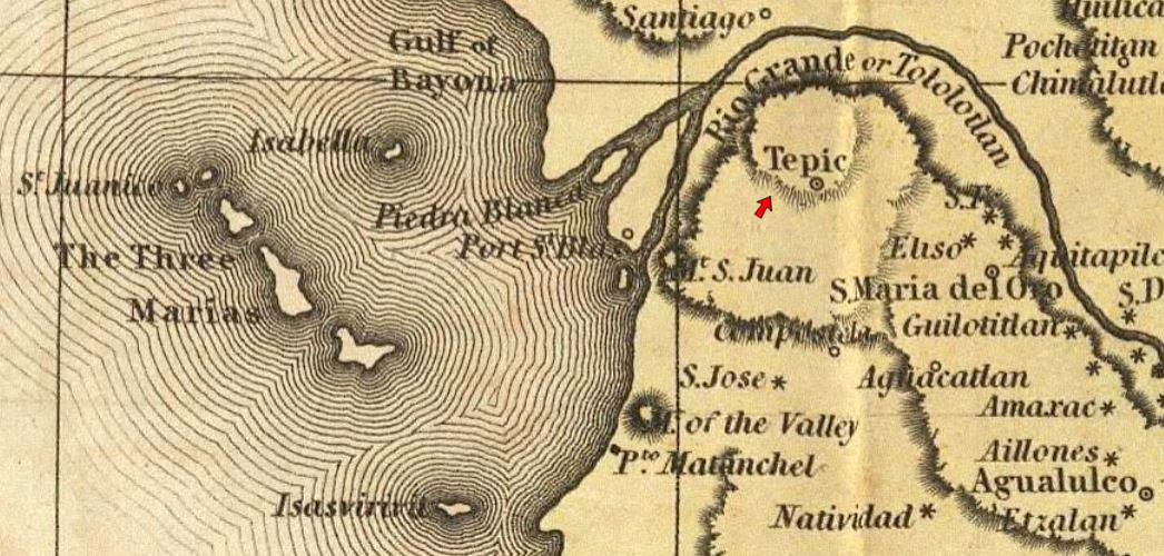
¶ 1.
—Eustace Barron: Barron was located in Tepic, Nayarit, Mexico.
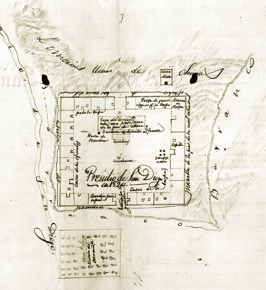
¶ 10.
—the [presidio] at San Diego: Below, a drawing of the San Diego Presidio's layout in its state circa 1820, as remembered decades later by Mariano G. Vallejo. North (strictly, northeast) is at top. The square at bottom indicates the community's orchard/vegetable plot (huerta). At left is the course of the San Diego River. The civilian community of San Diego (now Old Town San Diego) would be below the bottom margin of the image. Said bottom margin roughly follows the line of today's Juan Street.
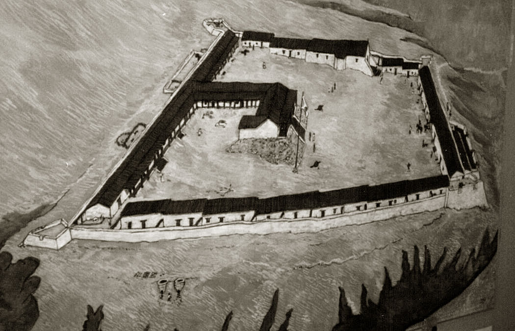
Below is a rendering of the appearance of the Presidio as it was some time after the era the above layout represents. North (northeast) is now at left. The orchard and town would be downhill and off to the right. The larger building in the center is the commandant's residence. Looking out from his front door, he would have a view over the town and of San Diego Bay in the distance.
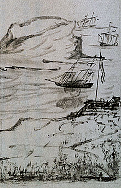
This is a rendering by Sandels of the presidio's castillo guarding the bay, as it appeared in 1843:
—[the presidio at] Santa Barbara: As we see by the flag, this represents the presidio's state during the era of Spanish rule. Unlike the other presidios, Santa Barbara Presidio had no castillo, "consequently the garrison was composed of cavalry" (Spanish Institutions of the Southwest, by Frank Wilson Blackmar, Johns Hopkins Press, 1891, p. 211). At upper left is Mission Santa Barbara before it had its current appearance with the twin belltowers.
A diagram of Santa Barbara Presidio, as presented by Bancroft (I:464):
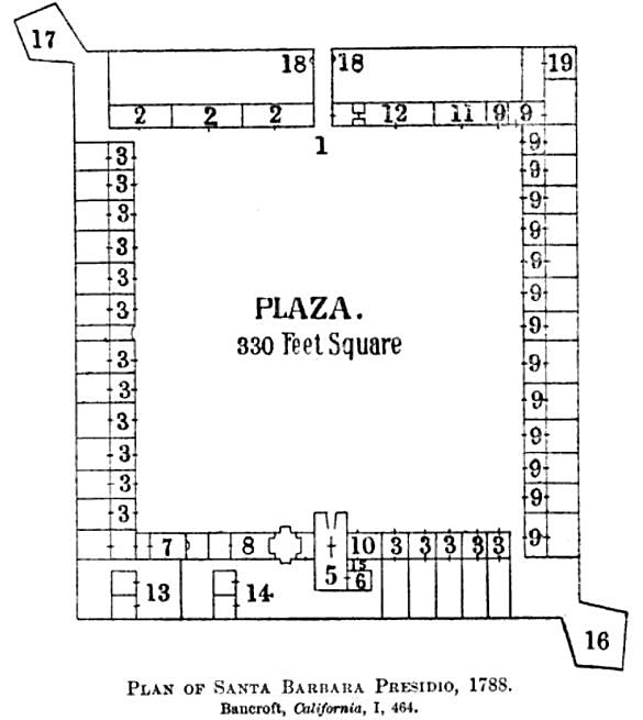
Key to the above (from Bancroft): 1, Chief entrance, 12 ft.; 2., storehouses, 16 x 61 ft.; 3, 18 family houses, 15 x 24 ft.; 4, false door, roofed, 9 ft.; 5, church, 24 x 60 ft.; 6, sacristy, 12 x 15 ft.; 7, alférez' suite, 3 rooms; 8, commandant's suite, 4 rooms; 9, 15 family houses, 15 x 27 ft.; 10, chaplain's 2 rooms; 11, sergeant's house, 16 x 45 ft.; 12, quarters and guard-room; 13, corrals, kitchen, and dispensa of alférez; 14, corrals, kitchen, and dispensa of commandant; 15, chaplain's corral; 16, western bastion; 17, eastern bastion; 18, corrals. (Item 4, missing on the chart, must be the area between number 5, the church, and number 8, the commandant's suite.)
— [the presidio at] Monterey: North is at the top (you can see the "N" under "Bahia de Monterey"). This layout was drawn by Mariano Guadalupe Vallejo from recollection.
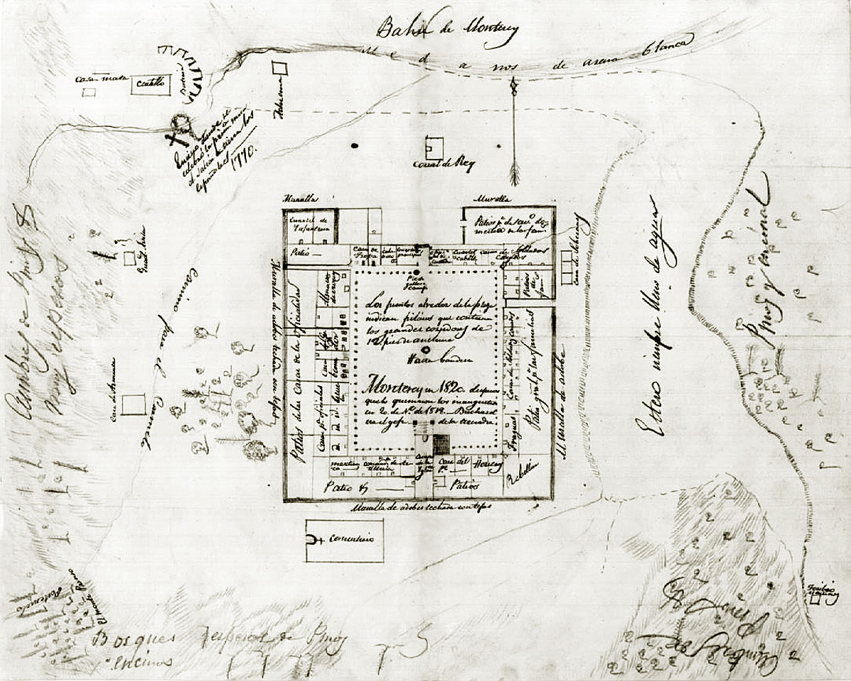
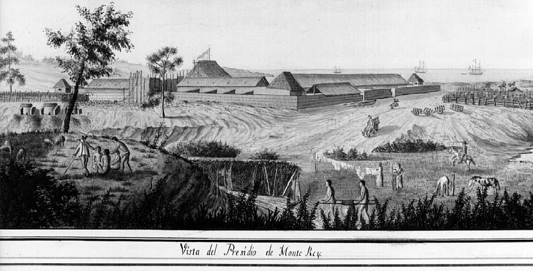
An early view (circa 1790) of the Monterey Presidio.
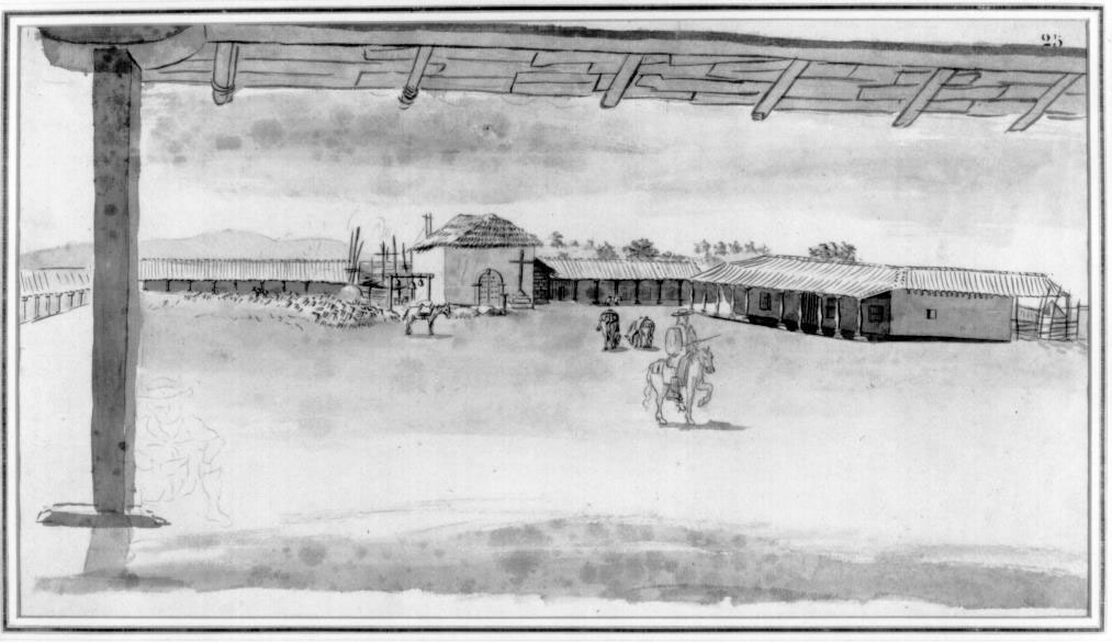
Inside the plaza/courtyard of the Monterey Presidio.
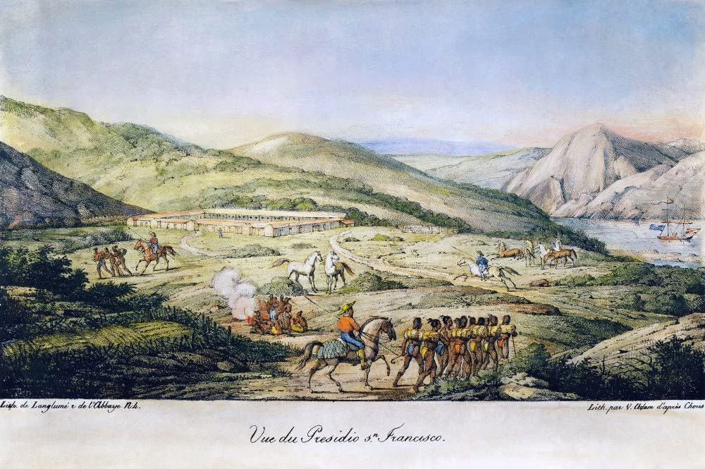
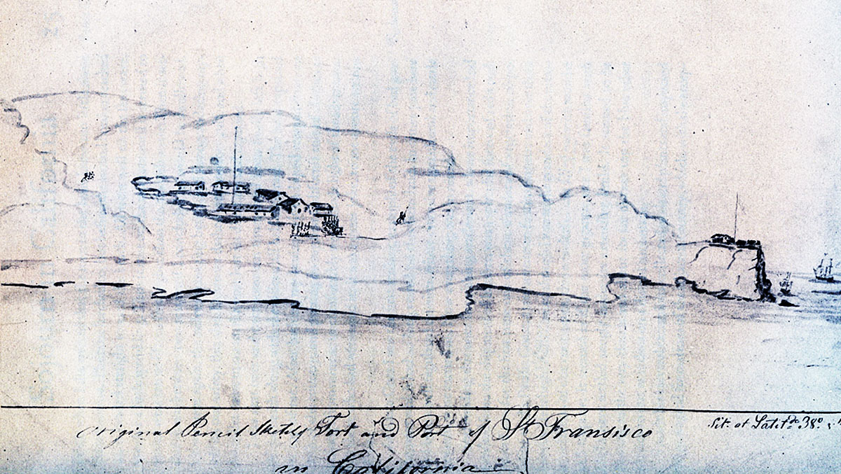
—and [the presidio at] San Francisco:
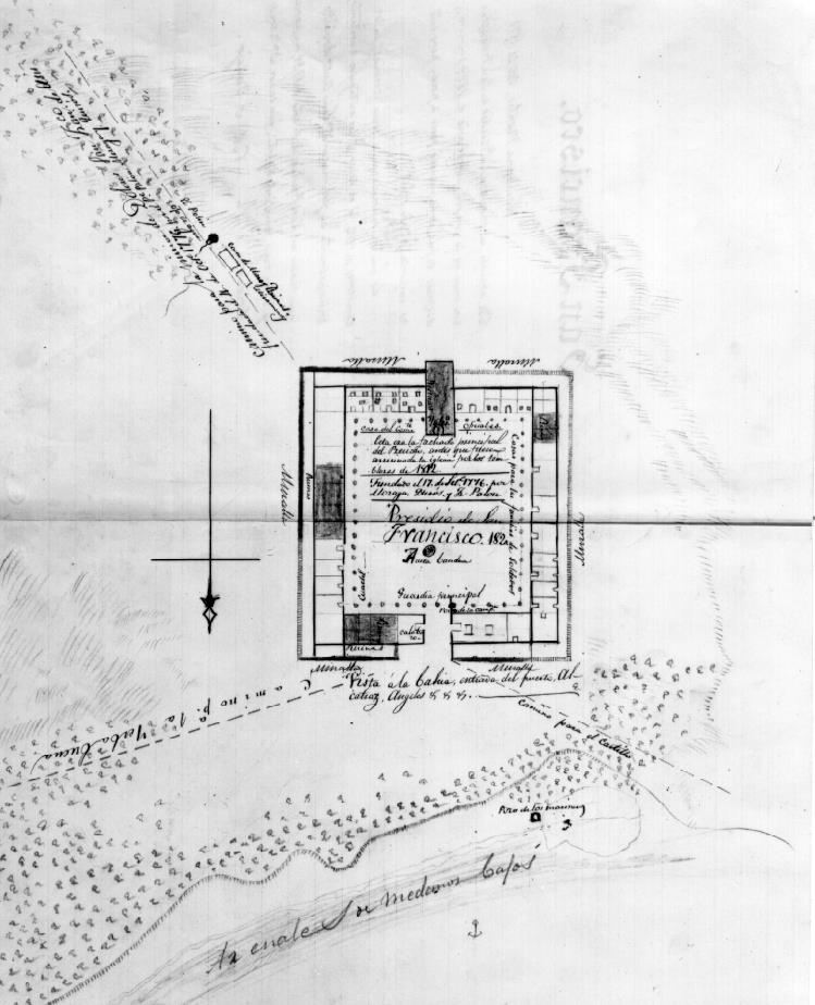
Mariano Guadalupe Vallejo sketched the presidio's layout as he thought it had been in 1820.
A Swedish-born visitor to California in 1842-1843, Dr. Gustavus M. Waseurtz af Sandels—also known as Emanuel Sundelius Edelhjerta—sketched the presidio and its castillo.
¶ 22.
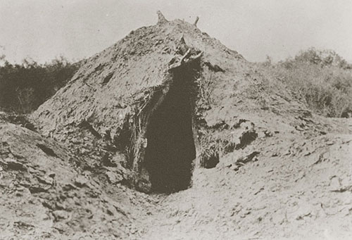
—continuous use of the sweathouse [temescal]:
¶ 24.
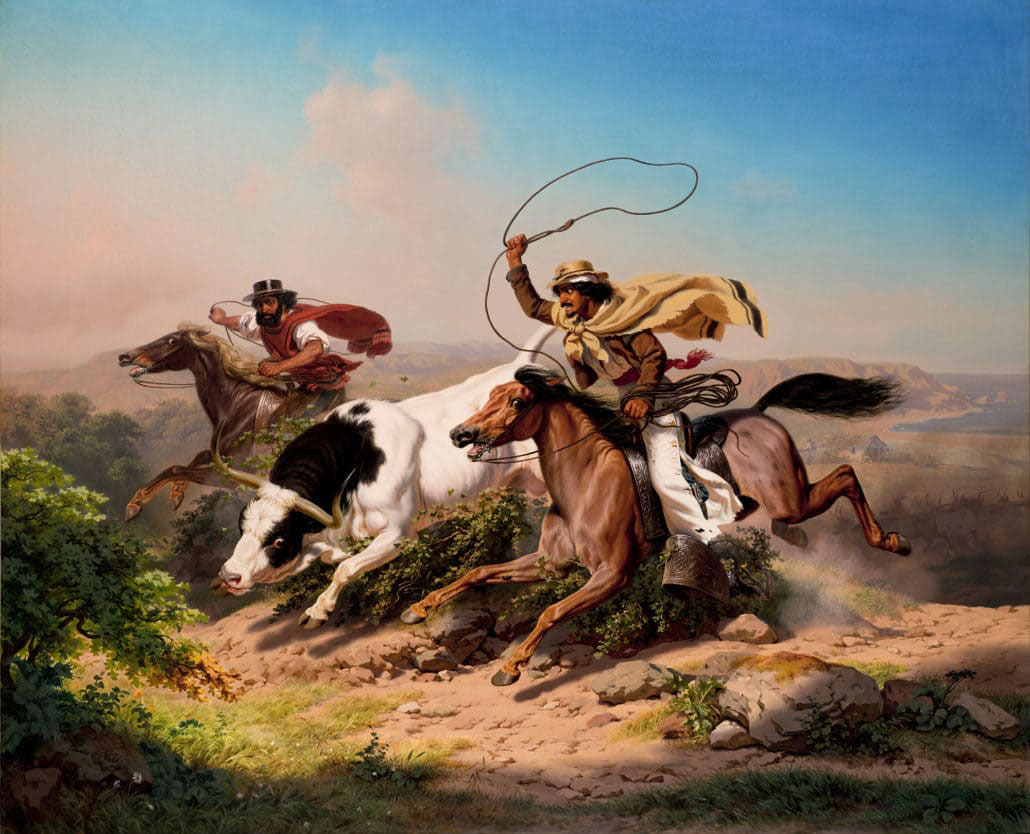
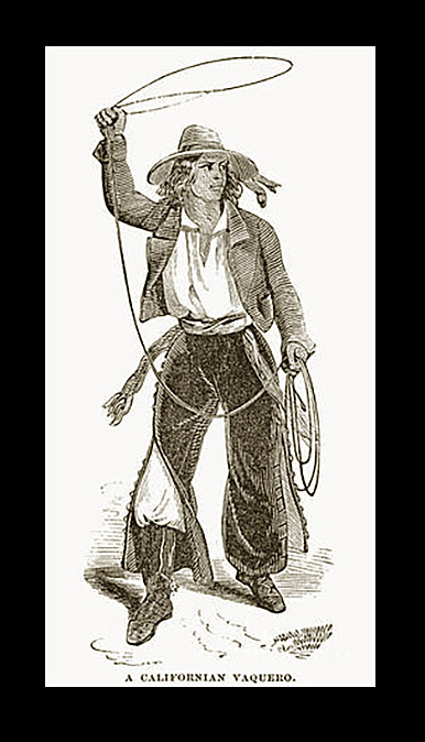
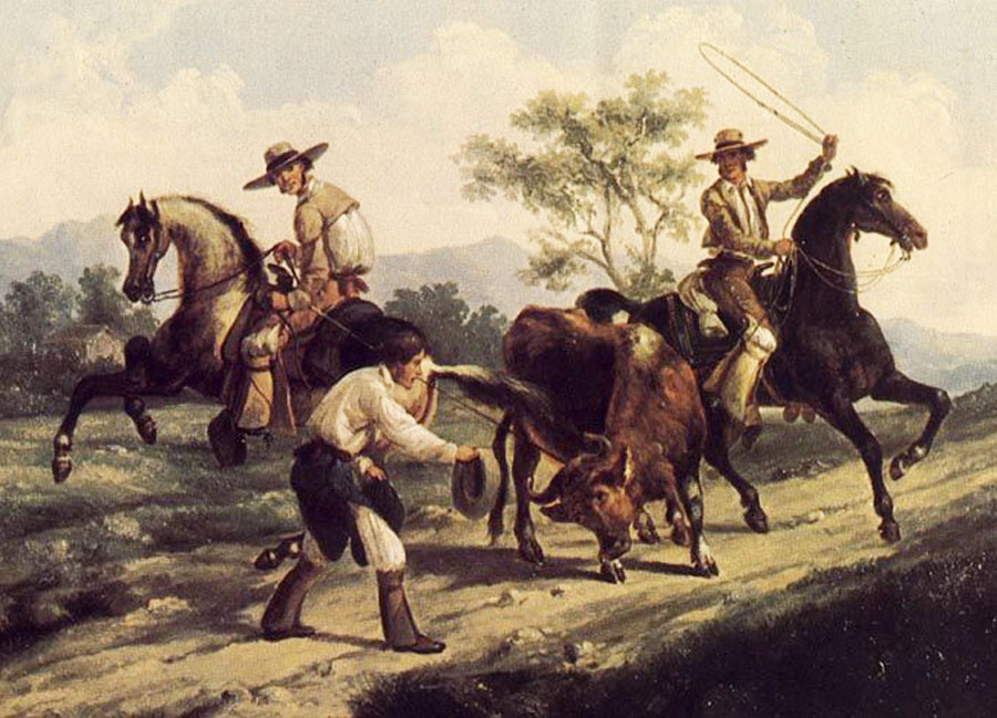
—raising cattle:
¶ 26.
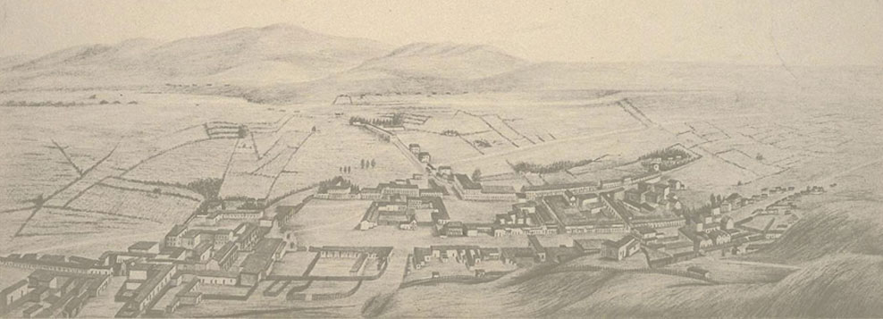
—Los Angeles: The traveler arriving from the east along the normal road would gain this view of the pueblo of Los Angeles as he was about to cross the Los Angeles River. This is a detail from Waseurtz af Sandels' sketch from 1843 (all that's missing is a lot of blank sky at top and the artist's i.d. of the location). The Plaza church can easily be spotted. Close examination will also reveal the famous Aliso tree and other familiar features of the pueblo.
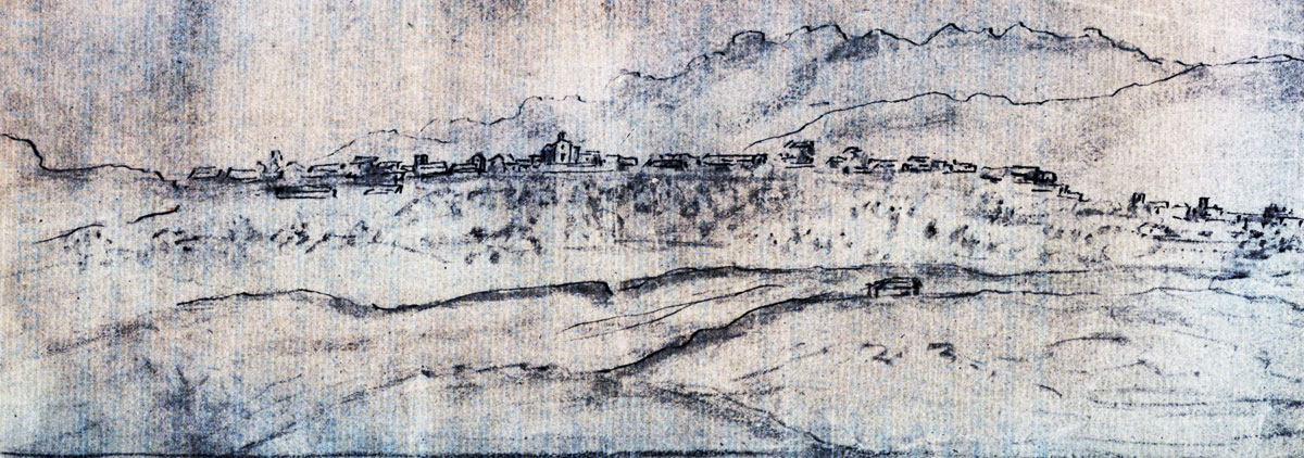
The traveler arriving from the south (say, the San Pedro road), would gain this view (below) on approach to the pueblo of Los Angeles. William Rich Hutton is the artist. (Image courtesy the Huntington Library, San Marino, California, detail of call number HM 43214 (27), used by permission.)
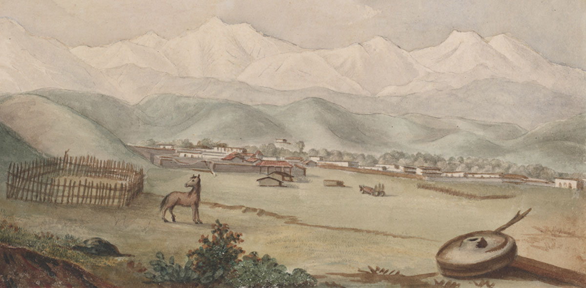
The traveler arriving from the north (through the San Gabriel Mountains) would gain this view (below) on approach to the pueblo of Los Angeles. William Rich Hutton is the artist. (Image courtesy the Huntington Library, San Marino, California, detail of call number HM 43214 (31), used by permission.)
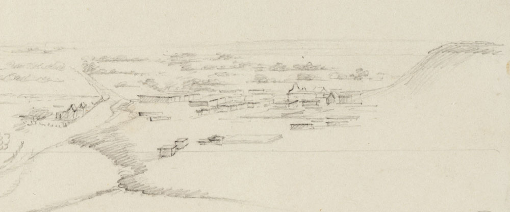
And here is how the traveler arriving from the west would first behold Los Angeles. The sketch is from Henry Miller, 1856:
¶ 45.
—I cannot help. Delete one of the two instances of "I cannot help."
¶ 103.
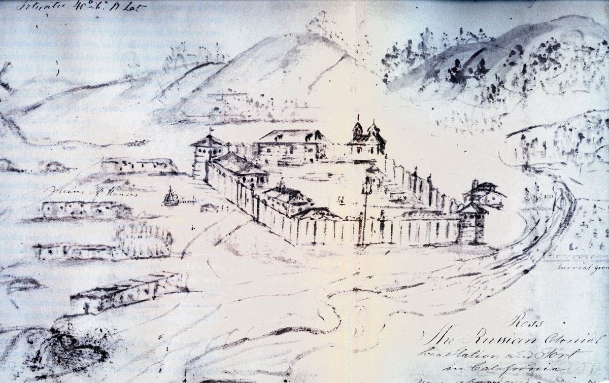
—the Russians have operated an establishment at the 40th parallel. Which is to say, Fort Ross, which was sketched by Sandels in 1843.
¶ 227–312.
—The Missions. While it would most sincerely delight me to provide here views of all the twenty-one missions as they were once upon a time, with further details inside and out, the reader would do best to consult the several fine sites devoted to mission history and studies as well as web pages offering accounts of travel, with photos, to the missions as they exist today, and to seek out the interesting and often beautiful individual views produced by Edward Vischer, William Rich Hutton, Henry Miller, Waseurtz af Sandels, and their contemporaries. I can, however, provide a few views here to illustrate sights or matters of particular interest.
¶ 227.
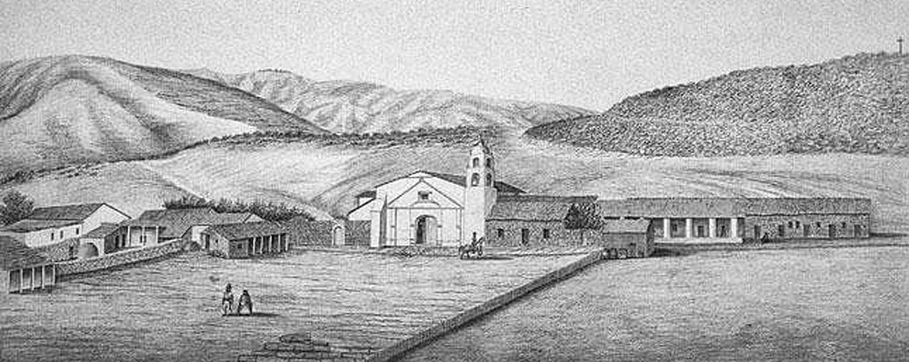
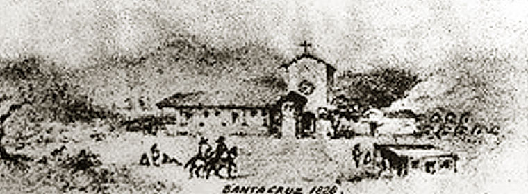
—[San] Juan Capistrano, San Buenaventura, and Santa Cruz are each situated close to a plaza.
• Mission San Juan Capistrano with adjoining plaza:

• Mission San Buenaventura with adjoining plaza:
• Mission Santa Cruz (1828), with adjoining plaza:
¶ 233.
—Town [...] of San Diego:
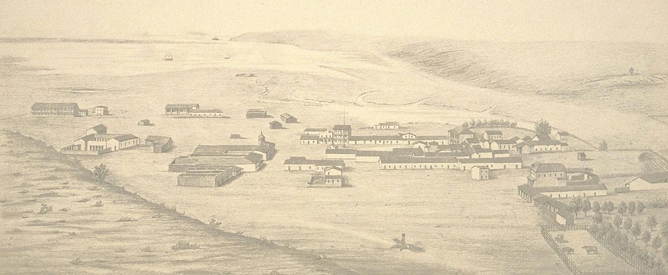
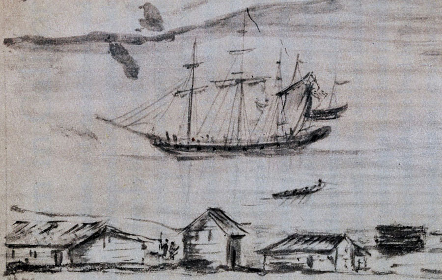
—shacks on the beach. These would be the oft-mentioned hide houses, of which Sandels gives us a view in 1843:
¶ 234ff.
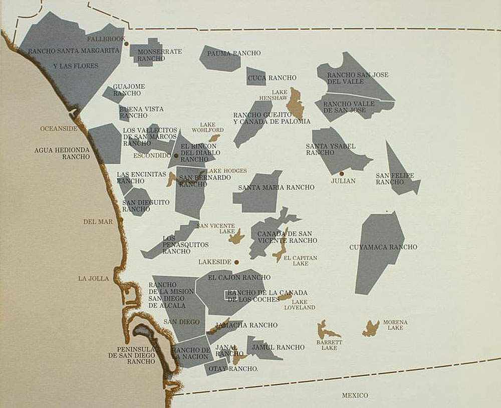
—ranches: Here are the ranchos of San Diego County, as of about 1845, from Richard F. Pourade's The Silver Dons, Union-Tribune Publishing, San Diego, 1963, p. 72.
¶ 255.
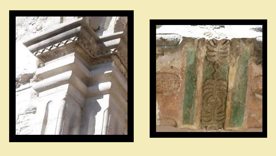
—[Mission San Juan Capistrano] stonework:
¶ 257.
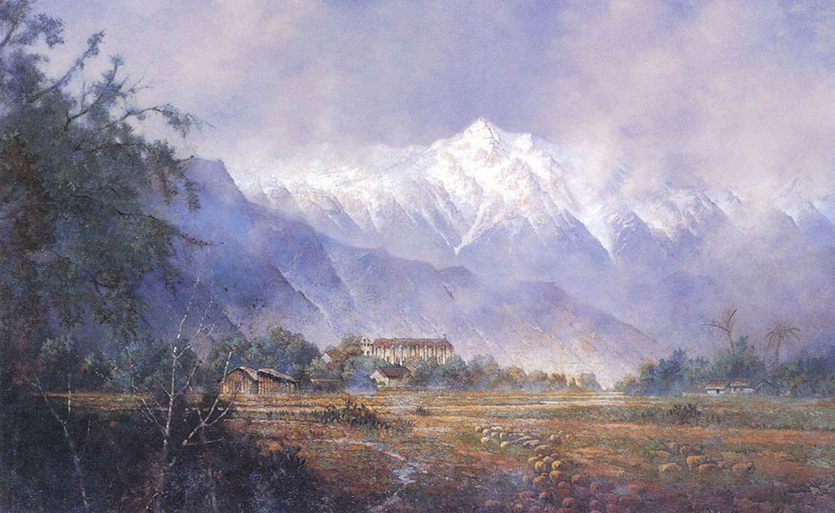
—Mission San Gabriel [...] Its location is on a plain in very pleasant surroundings.
¶ 284.
—[In the Gaviota Pass,] one specific very large one that juts out halfway.
¶ 288.
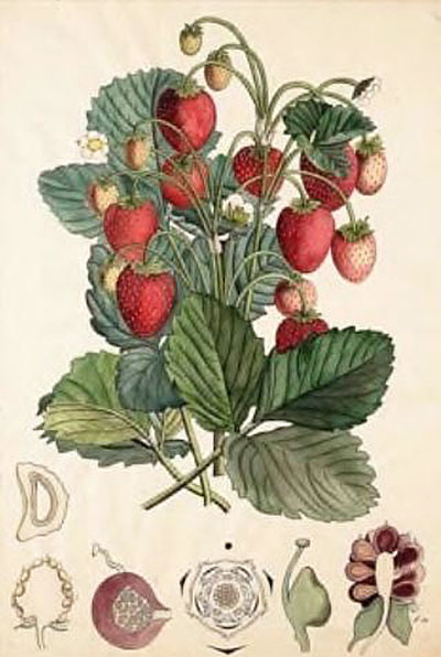
—wild strawberries of exquisite taste and enormous size.
¶ 296.
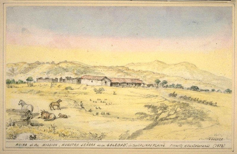
—Mission La Soledad.
¶ 298ff.
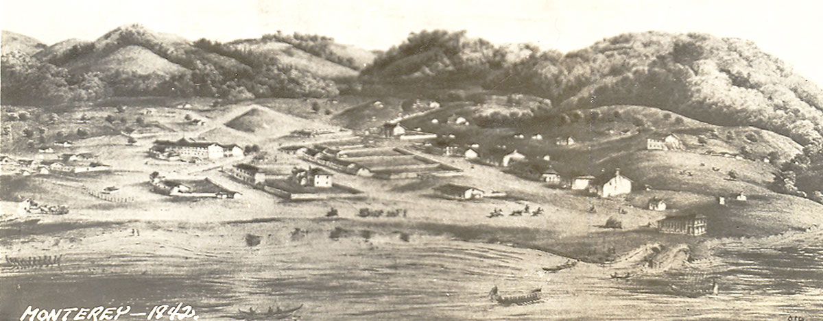
—Monterey. We should familiarize ourselves with the appearance of Monterey.
Monterey's castillo, by Henry Miller.
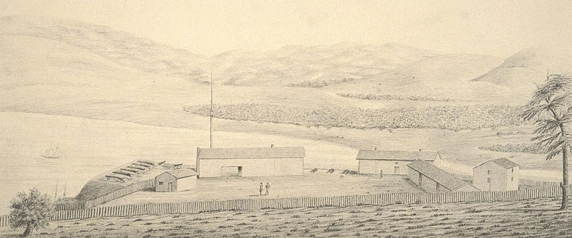
¶ 304ff.
—Santa Cruz. Detail from an 1851 map, showing the area between Monterey (bottom) and San Francisco (top). On the map we can pick out Mission San Jose, the pueblo of San Jose, Santa Clara, Santa Cruz, and San Juan (Bautista). The present Santa Cruz County is shown as Branciforte; but the Villa de Branciforte is not shown—only Santa Cruz, into which Branciforte had been incorporated.
—A view of Santa Cruz, with the (unmentioned) site of Branciforte as they were in the early 1870s.
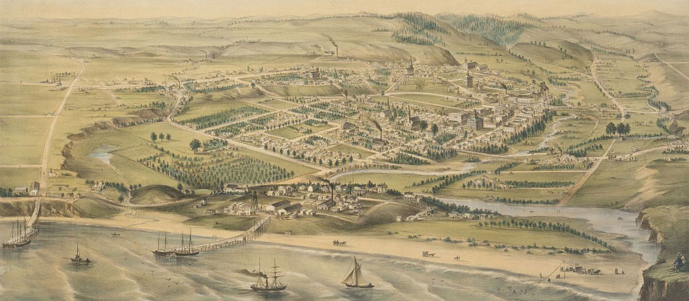
¶ 333.
—San Francisco. [...] This is a small town. Below is Sandels' 1843 sketch of Yerba Buena, on its way to becoming San Francisco. The key to the numbering is: 1. Hudson's Bay Co. building. 2. a mill. 3. house of Dionisio Garcia, or wash house belonging to Jack Fuller. 4. Embarcadero building, and/or residence of Captain Antonio Ortega. 5. house of Jack Fuller. 6. Vioget tavern. 7. building belonging to Captain John Paty. 8. home of Juan C. Davis. 9. house of Guillermo (William) Reynolds. 10. house of Pedro Sherreback. 11. house of Vicente Miramonte. 12. house of John Cooper. 13. Casa Grande. 14. warehouse of William H. Davis. 15. Kent Hall. 16. house of Captain William Hinckley. 17. building belonging to Mariano G. Vallejo.
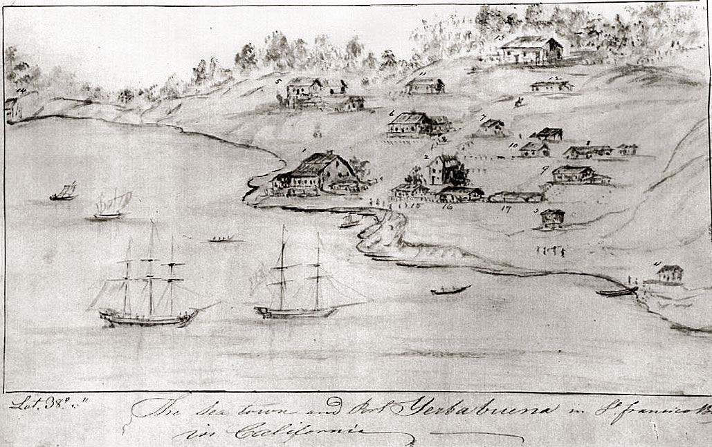
The reader will have looked in vain in the above for Mission San Francisco Dolores. Just as the presidio was some distance behind and to the right, the mission was some distance behind and to the left. Here is Vischer's reminiscence of how it appeared in 1842.
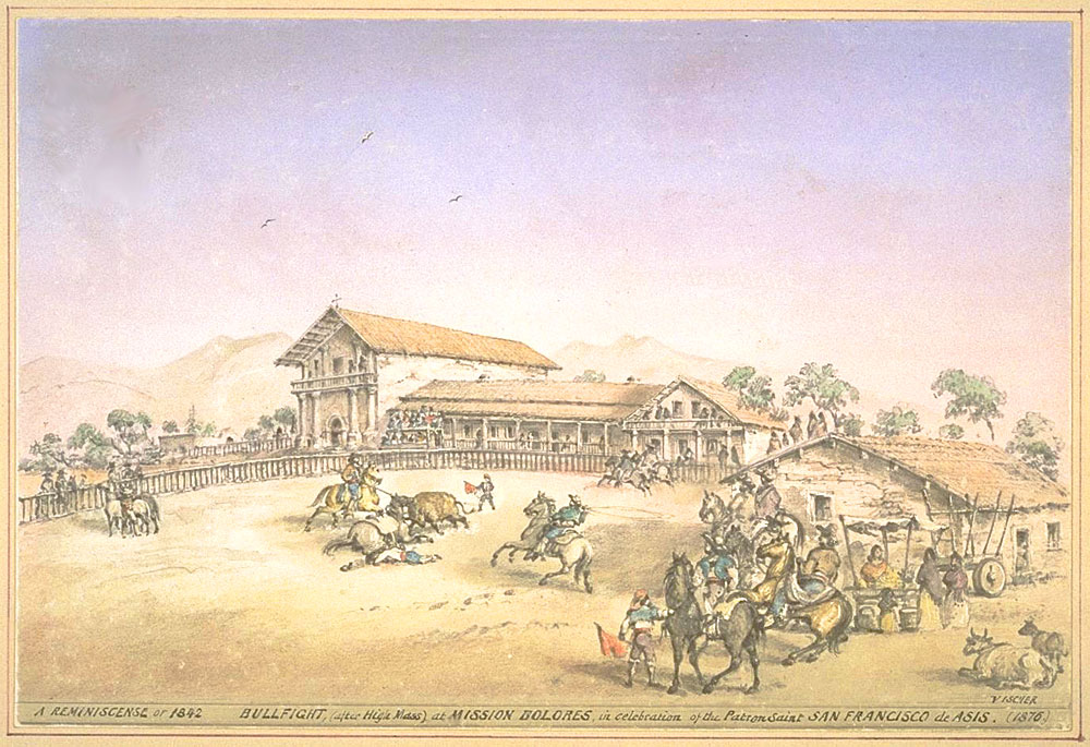
¶ 335.
—Sutter . . . who has built a fort.
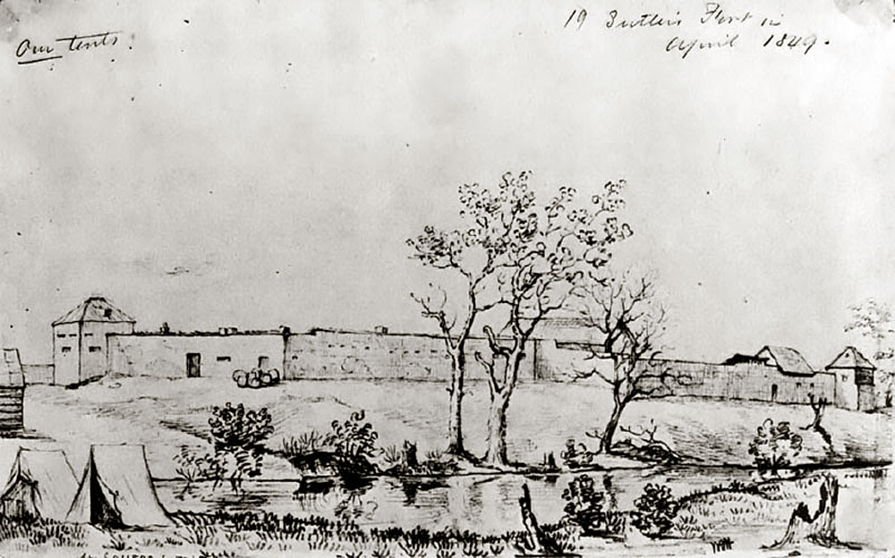
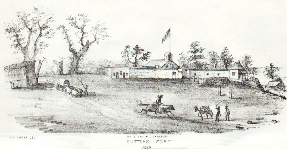
¶ 338.
—[I]t will be seen that there has been a considerable decline of Christian Indians, and that the pagans have increased somewhat.
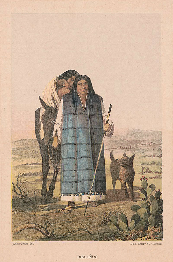
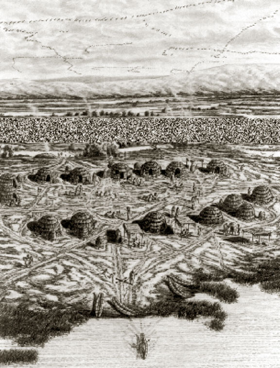
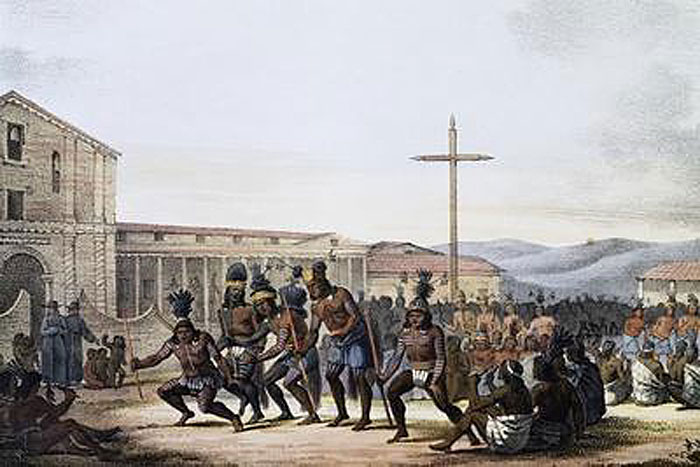
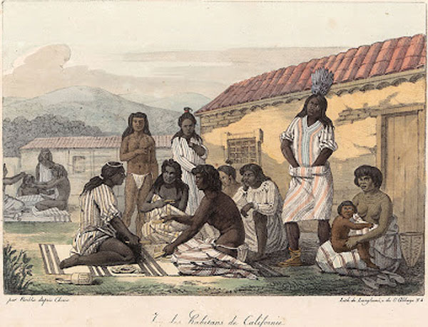
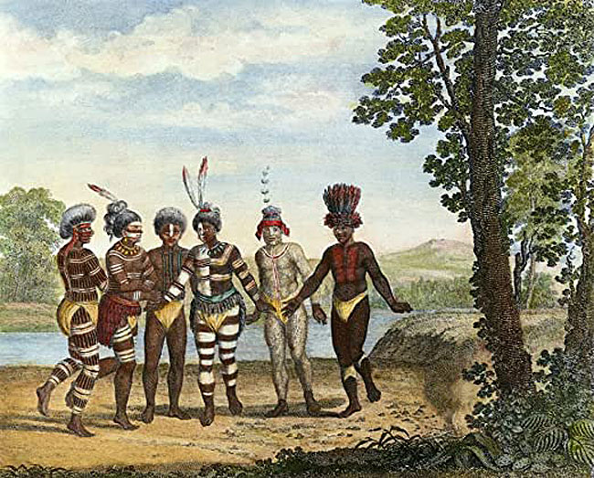
¶ 358.
—harsh treatment.
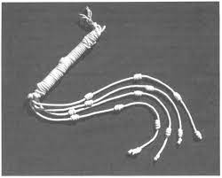
¶ 361.
—All told, the traveler will find in California people and attitudes that they will find delightful.
¶ 383.
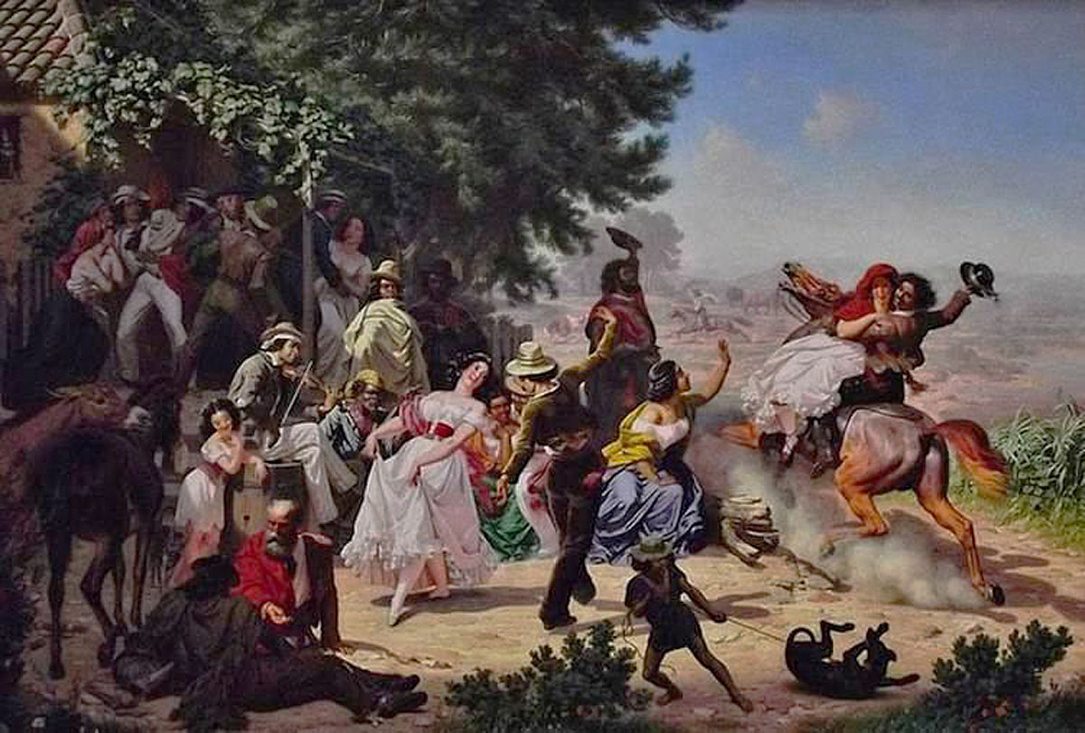
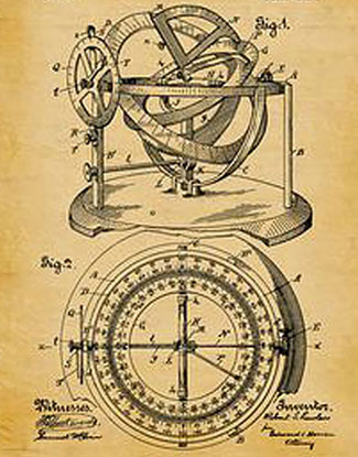
—You could say that it was a case of wheels within wheels.
• The following refers to information and/or text in the commentary and notes section.
¶ 1–3n.
—Wright. The reference to "Wright" in the note on José Bandini refers to Doris Marion Wright, editor of the 1951 edition of José Bandini's other draft of his History, in which edition she makes this remark in the course of the front matter ("p. vii").
¶ 272n.
—the greater Los Angeles aera. This should read "the greater Los Angeles area".
¶ 463n.
—future father-in-law Abel Stearns. Of course I intended to write "future son-in-law," but . . . didn't. Abel Stearns married Juan Bandini's daughter Arcadia June 22, 1841, at Mission San Gabriel.
• The reader may also find information and images of interest at my page pertaining to my book Narciso Botello's Annals of Southern California. To view the page, click on the image below.