Interpreting a Candor Chasma Landscape
This lab has the following objectives:
-
to have you revisit what you did in Lab 1, where you interpreted a fairly
uncomplicated landscape in Ganges Chasma, and apply those skills to a much
more complex landscape
-
to deepen your understanding of superposition and sequencing processes
operating in a landscape
-
to develop your active recall of the many physical processes and application
of the concepts involved to the landscape
-
to give you practice in map reading and interpretation!
Background
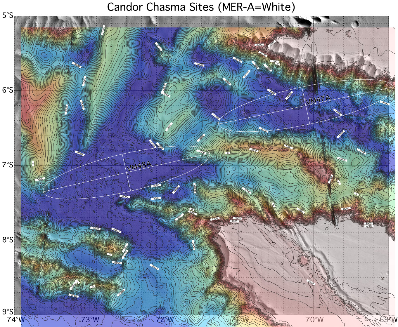
Candor Chasma is one of the subsidiary chasmata of Valles Marineris (north of
the main rift, just west of center. A contour map of the area is available at
http://marsoweb.nas.nasa.gov/dataViz/topsites/other/Candor.jpg.
This may help you interpret the image that is the focus of this lab.
Your data
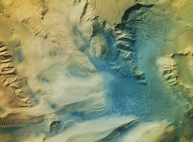
An image of Candor Chasma is available at https://home.csulb.edu/~rodrigue/mars/candorIR.jpg.
Download it and, notes and books at hand, pore over it, trying to identify
landforms, processes, and sequences, and where the heck it is.
Compare this image with the map link above. Identify where in the map the
image came from and how your image is, therefore, oriented with respect to the
Martian geographic grid. Where is north on the image?
______________________________________________________________________________________
Draw the outline of the region shown in the image onto the map, properly
oriented.
In your mind's eye, divide the image into nine cells, that is, three
equal-sized rows (1, 2, 3) by three equal-sized columns (A, B, C). If your
mind's eye wanders, you might want to draw these lines directly on your image.
Use this grid as a locational reference system.
Identify ten distinct landforms and the cells in which you see them (e.g.,
"blah, blah, blah in cell A3"):
-
______________________________________________________________________________________
-
______________________________________________________________________________________
-
______________________________________________________________________________________
-
______________________________________________________________________________________
-
______________________________________________________________________________________
-
______________________________________________________________________________________
-
______________________________________________________________________________________
-
______________________________________________________________________________________
-
______________________________________________________________________________________
-
______________________________________________________________________________________
What do the different color regions represent?
______________________________________________________________________________________
______________________________________________________________________________________
Why does the image vary in clarity from one location to another?
______________________________________________________________________________________
______________________________________________________________________________________
What are the linearities that run from the upper left to the lower right of
the image?
______________________________________________________________________________________
What are the parallel, mostly linear features on the planum surface in cell
B1? (they are also visible on the contour map)
______________________________________________________________________________________
What is that enclosed area in B3?
______________________________________________________________________________________
What is that uneven blue-green surface on the floor of the chasma in cell C3?
______________________________________________________________________________________
Which process dominates cell C3?
______________________________________________________________________________________
What are the parallel linear features along several of the cliffs in column A
and row 3?
______________________________________________________________________________________
Which surface has the most craters? The blue-greenish or the tan-beige areas?
______________________________________________________________________________________
You can see the head of one smaller tributary canyon in cell C2. Thinking
back on the discussion in class, what is the name given to that kind of canyon
head and which process of erosion typically gives rise to it, at least on
Earth?
______________________________________________________________________________________
Going back and forth between the image and the contour map, identify and
describe the lowest spot on the image and what its elevation with respect to
the areoid is (meters), what the highest spot is, and what the vertical
contrast in this image is.
-
Lowest elevation: ____________________________________________________________________
-
Highest elevation:____________________________________________________________________
-
Vertical contrast in elevation: __________________________________________________________
-
Your interpretation
On a separate, autographed sheet of paper, discuss the processes you see
operating here and the sequence of surface developments. Use your answers in
the previous sections and your rummaging about in the class notes, textbooks,
and Google to come up with a plausible narrative.
![[ image of Mars ]](https://home.csulb.edu/~rodrigue/mars/marsatlas.gif)