|
Introduction to Valles Marineris
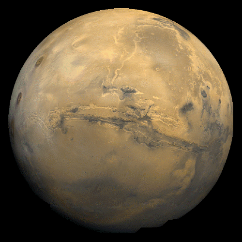
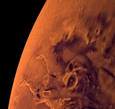
Valles
Marineris is a system of canyons located just south of the Martian
equator. In order to truly comprehend the sheer size of the canyon
system, one can compare its features to those of the Grand Canyon, the
largest canyon system on the planet Earth. Valles Marineris stretches
nearly 4000 km, a distance that would run coast to coast across the
United States. “The central individual troughs, generally 50 to 100 km
wide, merge into a depression as much as 600 km wide. In places the
canyon floor reaches a depth of 10 km, 6 to 7 times deeper than the
Grand Canyon (USGS).”
While the Grand Canyon was cut into the earth through water processes,
Valles Marineris is believed to be formed through fire; hot mantle
material rose to create Tharsis, in turn cracking the crust and
creating the canyon network. The Valles Marineris system was named
after the Mariner 9 spacecraft that was first to document it.
Source: USGS Astrogeology Research Program
The History of Valles Marineris
As with
any controversial scientific topic, how Valles Marineris was formed is
still being hotly debated today. At this time, there are two major
theories on how it came to be. One perspective involves a complex
geologic history: “first, the surface collapsed into a few deep
depressions that later became filled with layered material, perhaps as
lake deposits. Then graben-forming faults cut across some of the older
troughs thus widening existing troughs, breaching barriers between
troughs, and forming additional ones. At that time the interior
deposits were locally bent and tilted, and perhaps water, if still
present, spilled out and flowed toward the outflow channels. Huge
landslides fell into the voids created by the new grabens. Wind-drifted
material, mostly dark in color, apparently still moves along the canyon
floor and locally forms conspicuous dunes (USGS).”
Another perspective on the creation of the canyon system is that great
volumes of water had once cut into the Martian surface.
“Between the Valles Marineris proper and the Noctis Labyrinthus,
slightly to the south, is Oudemans Crater. Some believe this might have
been the trigger for some of the features of Valles Marineris as this
could have heated up the permafrost, turning the carbon dioxide to
liquid. Further decompression of the carbon dioxide ice could flow out
of the Noctis Labyrinthus, causing a catastrophic flood of carbon
dioxide liquid and gas into the northern plains. Oudemans is a complex
crater with a central peak uplift and impact melt, breccia in the
crater itself and ejecta surrounding it for about 13 km around from the
central uplift. North of Oudemans, in Valles Marineris itself, there is
a large area on the floor composed of grooved floor material with
irregular troughs and pits interpreted as alluvial deposits or
contraction by the removal of ice or fluid. There is also a small
portion of small conical hills thought to be small shield volcanoes.
This only comprises about two-thirds of the floor area north of
Oudemans, the other third is composed of more rough and smooth floor
material (Wiki).”
Source: USGS Astrogeology Research Program
Source: Wikipedia Valles Marineris
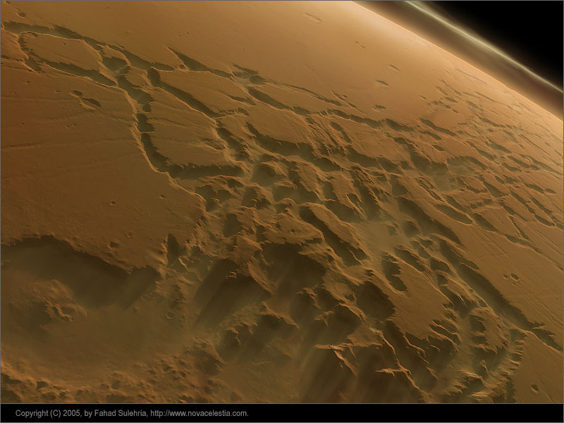
The Regions of the Canyon
Noctis Labyrinthus
Located at
the western end of Valles Marineris, Noctis Labyrinthus has
characteristics to support the theory that the canyons were created
through faulting. There are some areas in which it looks as though
surface materials have sifted downward into a gaping hole in the
subsurface.
Ius and Tithonium Chasmata
Within the
Ius and Tithonium Chasmata, circuilar depressions on the summits of
some cone-shaped hills have been interpreted by some as possibly being
cinder cones. Because of their relatively fragile composition of
volcanic ash, it can be inferred that they were created relatively
recently on a geologic timeline.
Melas, Candor and Ophir Chasmata
Melas,
Candor, and Ophir Chasmata, located towards the center of Valles
Marineris, are of particular interest to researchers. The varying
flatness of their floors demand further imagining to determine their
viability as potential landing sites for upcoming missions to Mars.
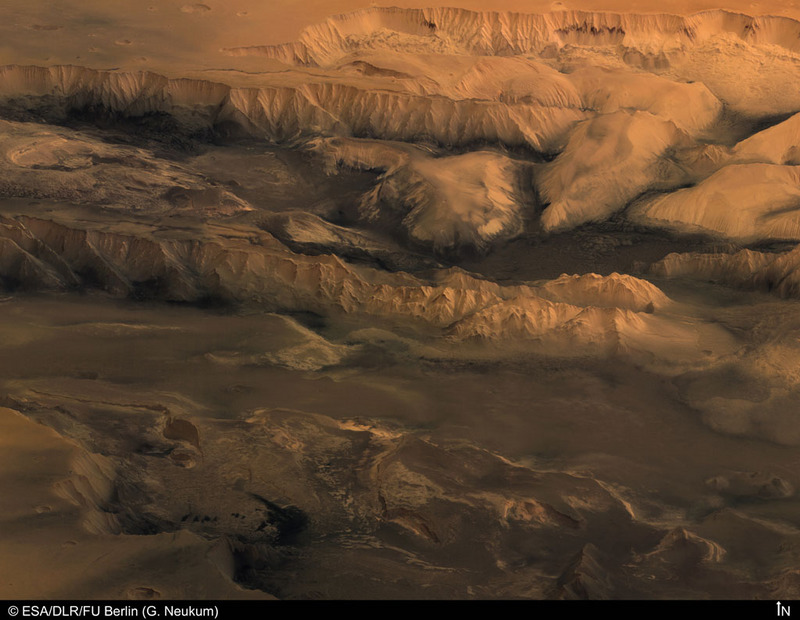
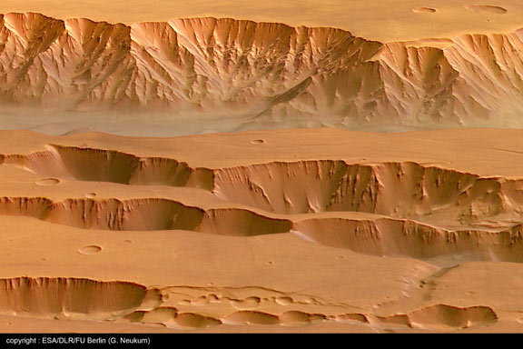
Coprates Chasma
Coprates
Chasma is also found near the center of Valles Marineris around 13.5
degrees South and 300 degrees East. Erosional effects are displayed by
the linear features extending from the upper edge of the trough walls.
The lower slopes appear much softer, most likely as a result of
atmospheric dust. Other parallel lines found in the area could possibly
be interpreted as faults.
Eos and Ganges Chasmata
The Gange
Chasma is a deep offshoot of the Eos Chasma. It gets its name from the
River Ganges in South Asia. The Eos Chamsa is found in the southern
part of Valles Marineris. The eastern end of this canyon has a large
area of streamlined bars and longitudinal striations. Some scientists
believe these may be stream-carved plateau deposits from material
transported and deposited by some form of flowing fluid, possibly
water.

Chryse region
The plains
of Chryse are most well known for being the successful landing site of
the Viking 1 lander as well as the Pathfinder spacecraft. The area was
named after a far-off island rich in gold. Rocks are prevalent in the
area, covering about 8 percent of the surface. Chryse Planitia is
popularly thought to be where vast amounts of water flowed at some
point in Martian history when examining fluvial evidence present
throughout the canyons of Valles Marineris.
|
|